Hurricane Isaias Intensifies Toward Gulf Coast Landfall
Tropical Storm Isaias is rapidly strengthening over record-warm Gulf waters and is forecast to become the season's first hurricane by early Thursday.
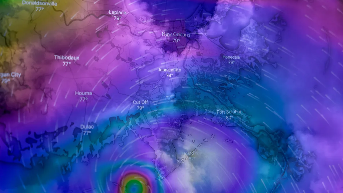
Tropical Storm Isaias is expected to quickly strengthen into the Atlantic season's first hurricane by early Thursday. The storm formed in the southwestern Gulf of Mexico early Wednesday and is moving east-northeast toward the northern Gulf Coast over record-warm waters, setting the stage for significant intensification.
At 1 p.m. EDT Wednesday, Isaias was located about 520 miles south-southwest of the Mississippi River's mouth. It had maximum sustained winds of 50 mph and was moving east-northeast at 8 mph. The environment is very favorable for strengthening, with sea surface temperatures near 30-31 degrees Celsius, moderate wind shear, and a moist atmosphere.
Intensification forecast and landfall timing
Isaias is forecast to peak as a major or near-major hurricane before making landfall Friday night or early Saturday morning. Over 60% of forecast ensembles bring Isaias to major hurricane strength. The National Hurricane Center is "calling for rapid intensification of 35 mph in the 24 hours from Thursday morning to Friday morning." High-resolution dynamical models are particularly enthused about rapid intensification prospects.
However, significant weakening is possible in the final 12 hours before landfall. A combination of high wind shear and dry air may breach the storm's core. The NHC currently has "Isaias peaking as a high-end Cat 2 hurricane with 110 mph winds on Friday morning." The storm will be accelerating and expanding as it approaches, with wind and storm surge as the main damaging impacts. Rainfall will be limited by the storm's speed, expected to be about 15 mph at landfall.
| Forecast Element | Detail |
|---|---|
| Peak Strength | Major (Category 3 or stronger) or near-major hurricane |
| Likely Landfall Window | Friday night or early Saturday morning |
| Current NHC Peak Wind Forecast | 110 mph (high-end Category 2) Friday morning |
| Rapid Intensification Forecast | 35 mph increase in 24 hours (Thu AM to Fri AM) |
| Key Inhibitors Before Landfall | High wind shear and dry air intrusion |
Impacts and preparations underway
Storm surge damage is expected to be significant regardless of any last-minute weakening. A hurricane watch is in effect from Bay St. Louis, Mississippi, to Indian Pass on Florida’s Panhandle. The storm could bring dangerous storm surge from southeast Louisiana to Florida’s Big Bend and trigger flash flooding with 3 to 7 inches of rain along the coast.
Florida and Alabama have declared states of emergency. Gulf oil producers have halted about 25% of regional production, taking roughly 511,000 barrels a day off the market. The city of Gulf Shores canceled its National Shrimp Festival, which drew an estimated 325,000 people last year. Officials are preparing emergency crews and urging residents to take precautions.
Forecast confidence and track influences
The storm’s eventual strength hinges on competing influences. It will traverse an eddy of deep, warm water which may aid intensification. Opposing this are strong upper-level winds from a large trough over the central United States, with shear predicted to rise sharply on Friday. A flow of dry air may also wrap into the storm's core. A faster, more easterly track would favor a stronger storm, while a slower, westerly track would expose it more to weakening influences.
The trough of low pressure affecting Isaias at landfall will inject considerable energy, significantly broadening its wind field and driving a damaging storm surge far to the east of the center. Residents well east of the forecast landfall location could experience a quick onset of deteriorating conditions on Friday afternoon and evening. On the current track, residents of southeast Louisiana remain under a Tropical Storm Watch and would be on the storm's weaker left-hand side.