Florida Shatters Rainfall Records Amid Widespread Flood Emergencies
Record-breaking rainfall triggered flash flood emergencies across Florida, with over 20 inches falling in some areas.
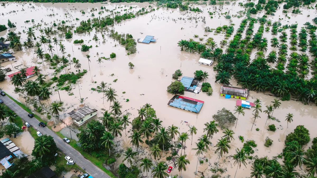
Florida experienced unprecedented rainfall totals that shattered records across multiple cities and regions. Between 15 and 20 inches of rain fell from Sunday through midday Monday in central Florida, with another two to four inches possible. Monday was Melbourne’s wettest day on record since 1937, with 10.28 inches recorded before noon. West Palm Beach received 22.2 inches of rain by Monday night, while Malabar saw over 24 inches and Palm Bay over 20 inches.
Flash flooding from repeated rain closed roads around Melbourne and Palm Bay, affecting homes in West Palm Beach, Riviera Beach, and Palm Beach Gardens. The National Weather Service declared a Flash Flood Emergency for West Melbourne and Palm Bay, Florida, at 9:30 a.m. EST Monday. A Flood Watch for heavy rains of three to five inches and a Coastal Flood Advisory for minor to moderate coastal flooding were posted through Tuesday night for much of South Florida.
Climate change connection
Human-caused climate change significantly increased the likelihood of these extreme rainfall events. Jeff Berardelli said, "The record rains have been boosted by record-to-near-record warm ocean temperatures off the east coast of Florida." Record-to-near-record warm ocean temperatures off Florida’s east coast made such rainfall events 10 to 100 times more likely due to human-caused climate change. The Florida rains exceeded the local definition of a 1,000-year six-hour rain event by a considerable margin.
Two additional 1,000-year rain events were documented since Friday: 19 inches in six hours in southwest Mississippi and over three inches in three hours in Henderson, Nevada.
National weather alerts and impacts
Multiple flash flood emergencies and warnings were issued across Florida and the Southwest due to extreme rainfall. The NWS placed the region in its 'Moderate' (level 3 out of 4) risk for extreme rainfall. A Flash Flood Warning was issued for interior portions of Florida at Sebring, where five to nine inches of rain fell, with another two to three inches possible.
In the US Southeast, persistent easterly onshore flow over the Florida Peninsula produced repeated rounds of heavy rainfall on Sunday and Monday. Florida’s extreme rains were caused by a moist easterly flow of air steered by a strong high-pressure system and a weak upper-air low-pressure system, leading to slow-moving thunderstorms and torrential rains.
Regional flooding impacts
Flooding affected multiple states including Arizona, New Mexico, Colorado, and the US Southeast with evacuations and infrastructure damage. Drenching rains caused widespread floods across the US Southwest. Heavy rainfall prompted evacuations in four separate states over the past few days due to flooding. Severe weather dumped months' worth of rain over parts of the U.S. Southwest this weekend.
A 'Pineapple Express' funneled warm, moist air into the US Southwest from over the Pacific Ocean. Storm systems passing over Arizona this past weekend dropped hundreds of millimetres of rain, normally what would fall over months. Mandatory evacuation orders were issued for communities in Arizona, New Mexico, and Colorado due to flash flooding.
| Location | Rainfall Amount |
|---|---|
| Crown King, AZ | 7.54 inches (192 mm) |
| Apache County | 5.9 inches (152 mm) |
| Navajo County | 5.5 inches (140 mm) |
| Gila County | Over 6.5 inches (165 mm) |
The heaviest rainfall was recorded in Crown King, AZ. This amount was 2 mm shy of the wettest day ever recorded there on April 17, 1917. Repeated swaths of rain over the past two months soaked the region with 200-300 per cent of normal rainfall for this time of year.
Much of the falling rain was funnelled down mountain slopes into local waterways, causing water levels to surge. Water levels on Oak Creek near Sedona rose from just over 3 feet to over 15 ft, reaching a maximum of close to 19 ft. Residents near Oak Creek were ordered to leave immediately as floodwaters trapped several people inside their homes. The small community of Gisela was completely evacuated due to rising waters on Tonto Creek, which reached 16 ft.
In Flagstaff, intense rainfall overwhelmed storm drains, turning streets into flowing rivers. Authorities in Tucson conducted around a dozen water rescues due to river flooding. All public roads were closed in La Pala, southwestern AZ, due to floodwaters. Communities in southern Colorado and northern New Mexico were impacted, with some given mandatory evacuation orders.
Residents in Pagosa Springs, southern Colorado, were forced to evacuate due to potential 'catastrophic flooding' from the San Juan River. The San Juan River at Pagosa Springs crested at 16.81 feet on Sunday, well beyond the 15.02 feet set on October 23. The San Juan River at Farmington, New Mexico, was predicted to crest at 12.06 feet on Monday evening, higher than any other crest on record since September 6, 1909.
Winter storm warnings were in effect for widespread 12- to 18-inch snow totals over the San Juan Mountains above 10,000 feet on Monday. Lake Powell was at just 25% of capacity as of November 1, despite wet October storms.
Coastal flooding also posed a major threat. Miami broke an 11-day streak of moderate coastal flooding on November 1, with two days at the 'Major' flooding threshold. Miami’s total moderate flood days for 2026 reached 15, surpassing the previous record of 10 days set in 2019. Four of the top water levels on record in Miami since 1994 occurred during the October 2026 king tides.
High tide flooding in Miami has increased sharply since 2015 due to sea level rise. Sea level in Miami has increased by about 1.12 feet since 1931, causing a one-in-10-year flood in 1931 to occur on 24 days between September 25 and November 2. Since 1994, sea level rise in Miami has accelerated by about 8 inches, with 36% attributed to human-caused global warming.
The October full moon high tides brought record flooding to San Diego and Los Angeles, with four of their top-10 water levels in over a century now held by October 2026. Coastal flooding in the 'Minor' range occurred both yesterday and today in South Florida, with additional minor flooding expected for the next 10 days. A Coastal Flood Advisory remains in effect through Tuesday night.